

A powerful monsoon trough drenches northern Queensland with relentless rain, triggering widespread flood warnings amid the 2026 wet season onset. Meanwhile, Tropical Cyclone Hayley intensifies off Western Australia’s Kimberley coast, threatening landfall with damaging winds and surges. These converging systems signal a turbulent start to the year, testing emergency responses across vast regions.
Cyclone Hayley’s Formation and Path
Tropical Cyclone Hayley emerged northwest of Broome as a category one system, packing gusts up to 120 kilometers per hour. Positioned over 500 kilometers offshore, it tracks southward along the Kimberley coast, drawing moisture from a developing monsoon flow. Forecasters predict rapid strengthening to category two status, peaking near 140 kilometers per hour before shear and terrain weaken it upon landfall.
The system skirts the Dampier Peninsula, with initial impacts on New Year’s Eve including heavy showers and thunderstorms. Projections show eastward movement post-landfall, potentially funneling moisture inland toward northern territories. Communities from Broome to Cockatoo Island brace for flash flooding, higher tides, and wind damage, with evacuation centers activated.
BoM warnings emphasize preparation, as Hayley taps enhanced outflow channels for brief intensification. Model consensus points to landfall timing around Tuesday morning, though slight uncertainties linger in track speed. This early-season cyclone underscores the Australian region’s active 2025-2026 cyclone season, already underway since November.
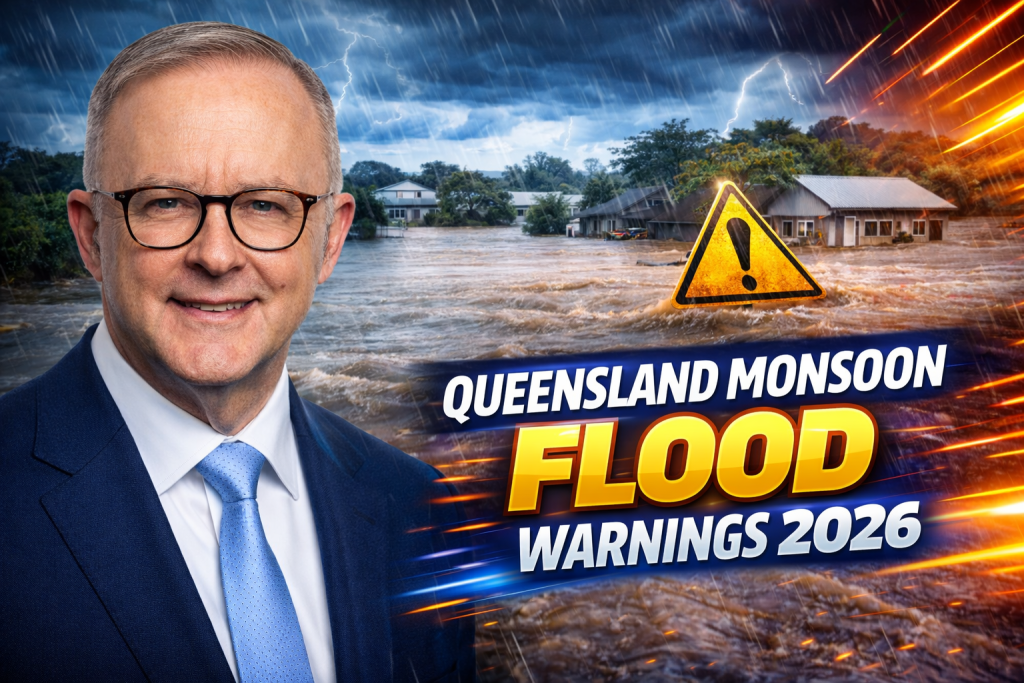
Monsoon Trough Drives Queensland Deluge
A slow-moving monsoon trough stalls over northern and western Queensland, dumping intense rainfall across the Gulf Country and tropical northeast. Peak six-hourly falls reach 75 to 120 millimeters in northwest areas, with thunderstorms amplifying totals. Four-day accumulations threaten 300 millimeters in western zones and over 700 millimeters near Cairns, fueling riverine and flash floods.
The trough’s persistence isolates remote communities, closing roads and inundating pastures. Authorities issue major flood warnings for key rivers, with sandbagging underway in Mount Isa and Hinchinbrook. This setup mirrors classic wet season patterns, where stalled lows prolong hazards beyond initial bursts.
Emergency services stockpile supplies and animal feed, anticipating weeks-long disruptions. Low temperatures compound agricultural stress, chilling livestock amid floodwaters. The system’s gradual southeast shift sustains pressure through early January.
| Affected Queensland Regions | Expected Rainfall (4 Days) | Flood Risk Level |
|---|---|---|
| Northwest (Mt Isa, Cloncurry) | 200-300 mm+ | Major |
| Far North (Cairns, Innisfail) | 600-700 mm+ | Severe |
| Gulf Coast (Normanton, Karumba) | 260-400 mm | High |
| Tropical Northeast (Townsville) | 400-600 mm | Moderate to Major |
Key Flood Warnings and River Levels
Major flood alerts dominate for the Flinders River, where levels already rise at Richmond. Moderate warnings cover Cloncurry and Western Rivers, with minor to moderate risks on Norman and Leichhardt. Flash flooding threatens urban creeks in Cairns and Townsville, where poor drainage exacerbates chaos.
Richmond observes rising waters from prior rains, now swelling with trough inflows. Mount Isa’s local councils activate alert levels, distributing sandbags door-to-door. Hinchinbrook Shire prepares for overbank flows, mirroring past deluges that submerged farmlands.
BoM’s flood watch extends from Gulf plains to Cape York, urging residents to avoid low crossings. Prolonged saturation raises landslide risks in tablelands. These warnings, current into early 2026, reflect the trough’s slow evolution.
| River/Catchment | Current Status | Peak Forecast |
|---|---|---|
| Flinders River | Major Flood Warning | Overbank Spillage |
| Cloncurry River | Moderate Flood Warning | Bankfull to Minor |
| Norman River | Minor Flood Warning | Localized Overflow |
| Gilbert River | Watch | Potential Moderate |
Impacts on Western Australia’s Kimberley
Hayley’s approach hammers Broome with escalating showers and gale-force winds. Coastal surges threaten low-lying areas, while inland heavy rain risks rapid creek rises. The region’s rugged terrain amplifies runoff, isolating highways like the Great Northern.
Pastoral stations face stock losses from drowning and cold stress, echoing prior cyclones. Ports halt operations, stranding supplies. Indigenous communities activate cultural burning pauses, prioritizing safety.
Tourism grounds flights, stranding New Year revelers. RAC Arena events proceed cautiously, but remote resorts shutter. Recovery hinges on post-landfall weakening, yet embedded moisture lingers.
Broader Monsoon Season Outlook
The 2025-2026 Australian monsoon activates early, with Hayley as the season’s first named cyclone. Darwin logs official onset criteria soon, boosting Top End rains. Long-range models hint equal chances for average totals nationally, but Queensland leans wetter into March.
Previous events like Tropical Cyclone Fina primed soils, heightening runoff. Streamflows surge along east coasts, contrasting low southern rivers. Heatwaves elsewhere strain grids, but northern focus remains floods.
Climate patterns favor active tropics, with southern Indian Ocean monsoons aligning. Equal rainfall odds mask extremes, as seen in November’s record northern wets.
Emergency Preparedness and Response
Queensland’s Local Disaster Management Groups elevate to alert status, coordinating rescues via helicopters. Stock routes activate for stranded cattle, with air drops for remote stations. Road closures span thousands of kilometers, from Burke Developmental Road to Peninsula Developmental.
Western Australia’s State Emergency Service urges cyclone kits: water, radios, medications. Evacuation hubs open in Broome, Derby. Cross-border aid prepositions for NT overflows.
Community apps deliver real-time alerts, while BoM radars track embedded cells. Sandbagging tutorials circulate, empowering locals. Prolonged isolation demands self-reliance, with resupply windows narrow.
Agricultural and Economic Toll
Flooded blacksoils drown crops and smother seedlings in northwest Queensland. Cattle muster halts, with losses mounting from hypothermia. Sugarcane belts near Cairns face mill delays, rippling to refineries.
Kimberley’s pearling and fishing halt, costing millions daily. Tourism bleeds from cancellations, hitting eco-lodges. Infrastructure repairs follow, straining budgets post-2025 recoveries.
Insurers brace for claims surge, prioritizing livestock policies. Government subsidies loom for pastoralists, echoing aid packages.
| Sector | Projected Losses | Mitigation Steps |
|---|---|---|
| Agriculture (Cattle) | High (Drowning, Feed Shortage) | Air Drops, Stock Routes |
| Crops (Sugarcane) | Moderate (Waterlogging) | Drainage Pumps |
| Tourism (Kimberley) | Severe (Closures) | Vouchers, Insurance |
| Infrastructure (Roads) | High (Washouts) | Temporary Bridges |
Community Safety Tips
Secure outdoor items against winds in Kimberley zones. Elevate valuables in Queensland flood plains. Monitor BoM apps for gauge rises, never drive through waters.
Stock non-perishables for seven days, charge devices via solar. Check neighbors, especially elders. Post-flood, avoid contaminated waters teeming with debris.
Volunteers man levees, but professionals handle swiftwater rescues. Mental health lines support stressed families.
Long-Term Recovery Strategies
Rebuilds emphasize resilient infrastructure: elevated roads, smart levees. Reforestation stabilizes slopes against landslides. Early warning expansions integrate AI tracking.
Policy shifts prioritize insurance reforms for remote holdings. Community drills harden resilience, turning survivors into leaders.
This dual threat—Hayley offshore, trough onshore—heralds a defining wet season. Queenslanders and Kimberley folk hunker down, united in defiance. As waters recede, stories of grit emerge, fortifying Australia’s north for future furies.

Vineeth T.C. is a news writer and digital content contributor at PageEuropean, covering key developments across New Zealand and Australia. His work focuses on delivering clear, fact-based reporting on current affairs, public policy, business updates, and regional news that matter to readers.